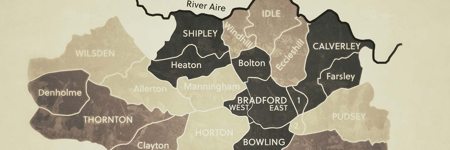
The Society covers the area described as the 1851 census registration district of Bradford, West Riding. The colours represent the sub-districts of Bradford, with their name in capital letters. The lower-case names are villages, hamlets or chapelries in the district.
The towns and villages we focus on are:
Adwalton, Allerton, Bierley, Birstall, Bolton, Bolton Woods, Bowling, Bradford, Bradford Moor, Burley, Buttershaw, Calverley, Clayton, Cleckheaton, Cullingworth Gate, Denholme, Drighlington, Dudley Hill, East Bierley, East Bowling, Eccleshill, Fagley, Farsley, Frizinghall, Fulneck, Great Horton, Greengates, Heaton, Hewenden, Horton, Hunsworth, Idle, Laisterdyke, Lidget Green, Little Horton, Low Moor, Manningham, Nab Wood, North Bierley, Oakenshaw, Odsal, Pudsey, Queensbury, Saltaire, Scholes, Shipley, Thornbury, Thornton, Toftshaw, Tong, Troydale, Tyersal, Undercliffe, West Bowling, Wibsey, Wilsden, Windhill, Wrose and Wyke


